If you’re a long-time reader of the site, then you know that I am trying to visit every county in the United States (I’m about 70% of the way there). Recently, while my family and I were in Hawaii, my son and I took one day to visit every county in Hawaii. We decided to plan our trip to visit all 5 Hawaii counties in one day. There are only 5 counties in Hawaii, but it includes Kalawao County, which is quite possibly the most difficult county to visit of all 3,143 counties in the United States.
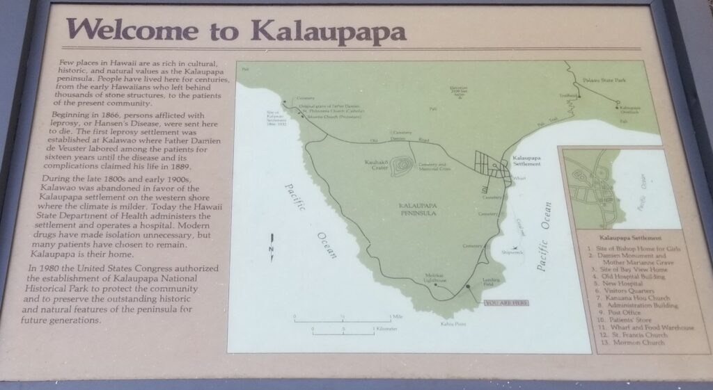
Why is Kalawao County so difficult to visit (Kalawao County history)
Kalawao County mostly consists of the town of Kalaupapa, which is on the north shore of the island of Molokai. It’s separated from the rest of the island of Molokai by huge cliffs, and there is no road access between Kalaupapa and the rest of Molokai. The only way to access Kalawao County is through a steep switchbacking hiking / mule trail, or of course by sea or boat. It’s the smallest true county in the United States, and its population of 82 is the second-smallest of any county (behind Loving County, Texas)
That would make it difficult enough, but the whole reason that Kalawao County even exists as its own jurisdiction is that it was first created as an isolation spot for people with Hansen’s Disease (leprosy). From 1866 to 1969, Hawaii exiled anyone with leprosy to this part of Molokai, and set it up as its own county and jurisdiction. After an antibiotic treatment for leprosy was developed in the 1950s, the quarantine was lifted, but many of the residents chose to remain on Kalaupapa.
Kalawao County is now coterminous with Kalaupapa National Historical Park, and you have to have a permit to enter the county / park. Before COVID, there used to be helicopter tours as well as a 2 hour mule ride tour, but those went away during COVID and haven’t come back. To my understanding, there is not currently a way to get a permit to visit Kalawao County for tourism.
Planning to Visit Kalawao County
So, how was I planning to visit Kalawao County. Before my trip, I decided on a 3-pronged approach
- Mokulele Airlines / Southern Airways flight 583 from Honolulu (HNL) to Molokai (MKK) that has a brief stopover at Kalaupapa (LUP). There was conflicting information from Flightaware about whether or not the flight actually stopped there, but it felt like a good shot
- When I arrived in Molokai, I booked a taxi to take me to the trailhead of the tail down to Kalaupapa. Although the trail is blocked, I was told that shortly after the fence at the road there was a sign indicating the county border. While I didn’t want to go down the trail all the way to Kalaupapa, I didn’t see a problem with going to the county border and taking a picture of the sign
- Intrepid county counters have identified the plot maps and determined that if you go to the Kalaupapa overlook (up on the top of Molokai), that the far northwestern portion of the overlook was actually in Kalawao County.
I figured between those 3 options, at least one of them would work for me.
Kalawao County Trip Report 2023
The first part of our Kalawao County trip planning was the flight from HNL to LUP to MKK. We had a bit of a layover at the Honolulu Airport, which we spent in the HNL Plumeria Lounge.
(SEE ALSO: HNL Terminal 2 IASS lounge – I may have found the worst Priority Pass lounge in the United States)
When it was time for our flight to Molokai, we had to take the HNL “wiki wiki” shuttle over to Terminal 3 which handles Mokulele Airlines.
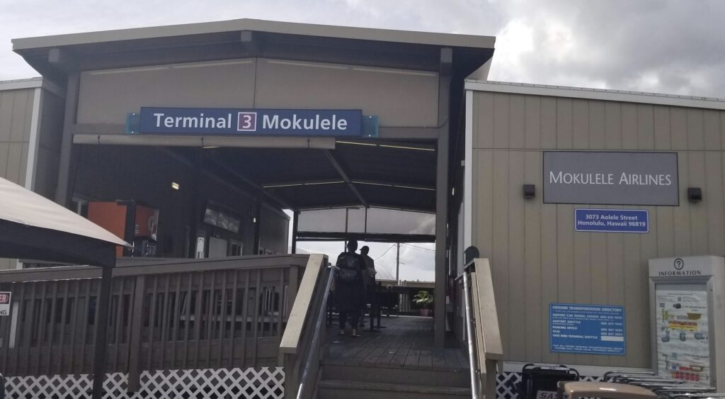
Since there was no security or line or anything, we got there a bit early, so we had time to kill while we waited for our flight.
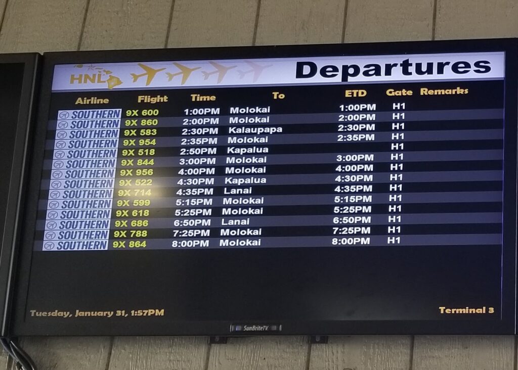
There had been some suggestions based on FlightAware flight tracking data that the flights did not actually stop in Kalaupapa and just went right to Molokai. I asked about this at the Mokulele gate at the commuter terminal, and the gate agent said that it did always stop there. I also asked the pilot about it, and he said that “this line” (I assume he meant the flight that was scheduled with the LUP stopover) always did. In my case, we were actually picking up 2 passengers at LUP, but he said even if we were not, that they always stop at LUP before flying up to the “topside” (MKK). I will also say that my observations after tracking Mokulele flights on Flightaware all day yesterday are that FlightAware does not always capture the reality of Mokulele / Southern very well. For example, my 1/31 2:30pm flight from HNL-LUP-MKK does not even show up on FlightAware. Also to be clear, you are not able to exit the plane at Kalaupapa (though I suppose I didn’t actually ask if I could get out to take pictures – maybe they’d let you?)
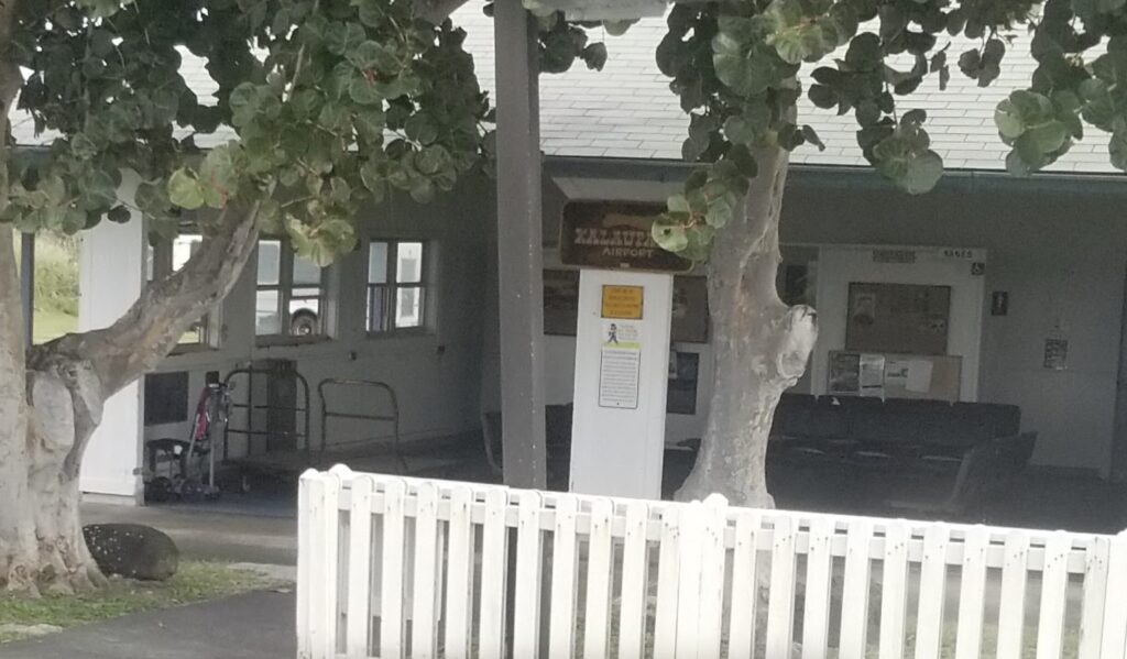
So while I’m not sure I’d want to necessarily COUNT on flight stopping at Kalaupapa, I think it’s probably worth booking that particular flight if it fits your schedule. YMMV of course, and I will say that Mokulele definitely embodies the “island” spirit of laidbackness 🙂
Arriving on Molokai
The 2nd prong of my Kalawao attack was renting a taxi at the MKK airport. I used the contact form for Hele Mai Taxi and someone got back to me within a day or two. They quoted me $30 each way to the Kalaupapa trailhead / overlook and then back to the airport, plus 30 cents per minute waiting time. But when we got to the overlook after already stopping at the trailhead, the meter said $32 and the driver said “how about we just call it $32 plus $32”, which was fine with me. So the total cost was $64 plus I tipped $15. There is an Alamo car rental office and a few car hire places. The one I contacted wanted to charge me the full day rate of $150 even though I’d only have the car for an hour or two. I believe Hele Mai is a family-run / family-owned business, and my driver was super friendly and personable. They are closed on Sundays. He was impressed that I had even heard of Kalawao County and was impressed with how much I knew about the geography / topography of the overlook and trailhead. I told him that this was the “Super Bowl” of county collecting and that there were lots of people that would want to hear my report 🙂
I gave Hele Mai taxi my flight information, and they were waiting in a parking lot to the left when we arrived. I was a little unsure as to where to go, but someone at the airport noticed me wandering around and pointed out the taxi. It takes about 15 minutes to drive to the trailhead. There’s a spot to the side of the road that you can park at. I told the driver that we were going to go down the trail a bit to take pictures of the sign.
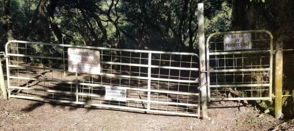
As you can see from the pictures, the trail is closed and says “permit required”. I did not have a permit nor do I think that you can currently even get one if you wanted to. My son and I hopped the fence and walked down the (somewhat muddy) trail. I did not see the pictures that others have posted that said “Welcome to Kalawao County”. We hiked about a quarter of a mile to the Welcome to National Park sign pictured below, at approximately 21.174749,-156.9987991.
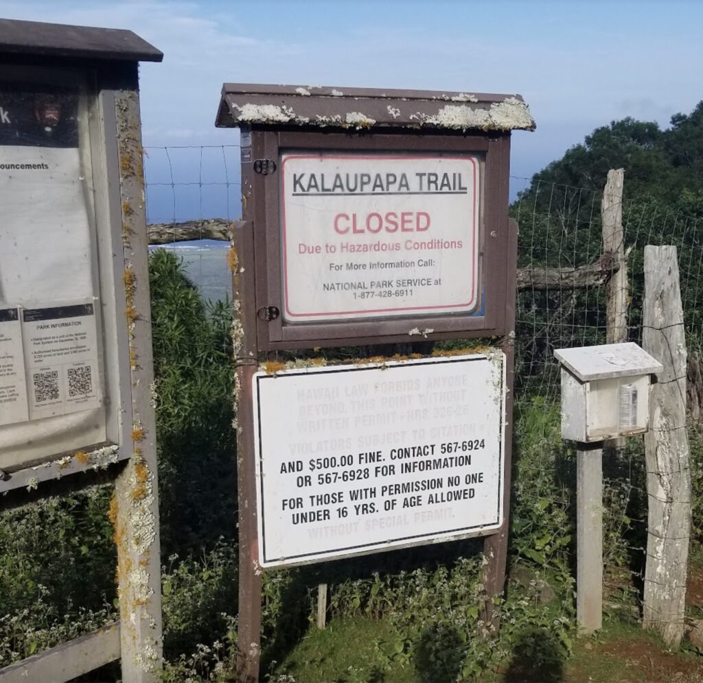
So I don’t know if the welcome sign is no longer there, or if maybe I didn’t go far enough to claim Kalawao from this “prong”. This was right before the trail turned to the right and started going down a steep set of stairs.
The third stop was over to the Kalaupapa Overlook. Previous research in this group has indicated that the far northwestern corner of this overlook is in Kalawao County, so we did that too, as well as snapping a few pictures.
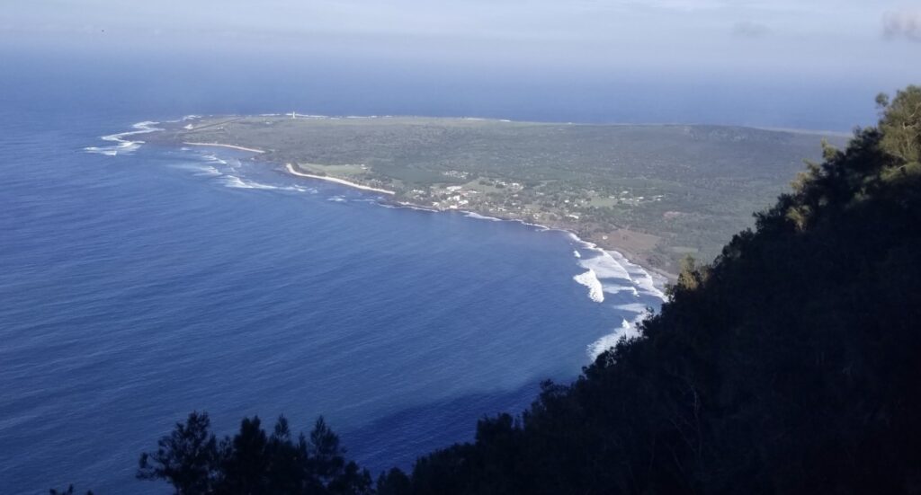
You can also go to “Phallic Rock”, which we did. Then it was back to the airport. We had reserved the 7:30 flight back to Kahului / Maui (OGG) but because our trip only took about an hour or so, they were able to get us on a flight a few hours earlier. So I would say that we definitely visited Kalawao County from the plane trip as well as the overlook, and I’m 50/50 as to whether we went far enough on the trail to get into Kalawao County. But 2 out of 3 ain’t bad, as Meatloaf might say…
The Bottom Line
I get that whirlwhind travel like this is not for everyone, and in fact even from county counters there was some pushback that I “should” take a few days to visit each of the islands. And while I do get that perspective as well, and I would like to go back to some of the other Hawaiian islands I didn’t get to fully explore, I would also like for people to stop telling me how I “should” travel.
Ever been to Kalawao County Hawaii? Or if not, what’s the most “difficult” place that you’ve been to? Leave your experience in the comments
This site is part of an affiliate sales network and receives compensation for sending traffic to partner sites, such as thepointsguy.com. This may impact how and where links appear on this site. Responses are not provided or commissioned by the bank advertiser. Some or all of the card offers that appear on the website are from advertisers and that compensation may impact on how and where card products appear on the site. Any opinions expressed in this post are my own, and have not been reviewed, approved, or endorsed by my advertising partners and I do not include all card companies, or all available card offers. Terms apply to American Express benefits and offers and other offers and benefits listed on this page. Enrollment may be required for select American Express benefits and offers. Visit americanexpress.com to learn more. Other links on this page may also pay me a commission - as always, thanks for your support if you use them
User Generated Content Disclosure: Points With a Crew encourages constructive discussions, comments, and questions. Responses are not provided by or commissioned by any bank advertisers. These responses have not been reviewed, approved, or endorsed by the bank advertiser. It is not the responsibility of the bank advertiser to respond to comments.


 Dan Miller travels with his wife and 6 (SIX!) children. He loves to help families travel for free / cheap, especially larger families. If you are looking for help, drop him an email at
Don’t know if “difficult” or “hair-raising” is the better word, but driving the road to the Pikes Peak summit in CO, was mine. This was late 70s in the era before anti-lock breaks, in a rear-wheel drive mid-size car. The road then was compacted dirt/gravel with numerous switchbacks and no guardrails protecting one from falling 500 feet or more. On the way down, signs warned, “Don’t burn out your brakes, use low gears. At some point on the
descent, there was a required stop where a state trooper checked the temperature around the brake area. Too high? Pull into a turnout to let them cool.
That happened to my dad on his drive down (he had to pull over to let his brakes cool). When I went to Pikes Peak a few years ago we took the cog train up and down.
Also did the cog train on our 2nd trip there. Much better choice!
I do enjoy reading your blog, but this post has been bothering me. I’ve been thinking about this report and while it’s always interesting reading about Molokai, I think it’s also irresponsible to write about ignoring warning signs. It’s a big issue on Hawaii, just look at proposed SB 786. It’s also about respect, especially since you’re not a local. Do you always ignore warning signs or just the ones that suit you? What kind of lesson does that teach children? See also: https://twitter.com/i/web/status/1478965713087840256 and https://www.buzzfeed.com/morgansloss1/this-native-hawaiian-woman-is-urging-people-to-stop just to give a tiny sampling.