So as long-time readers know, I am trying to visit all 3,143 counties in the United States. It’s taking some time :-). Actually I’m making pretty good progress and am currently at 1752 counties, or about 55.8%. Back in 2007, I had a series of week-long training classes in Chicago. Okay who am I kidding about “sometime”, it was April 9th 2007. Since the shortest distance between two points is no fun, I traveled from Cincinnati to Chicago by way of southern Kentucky (and back to Cincinnati by way of the Upper Peninsula of Michigan)
My travel mistake
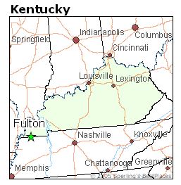
So on my travels in 2007, I was in the city of Fulton, Kentucky, which is in the very southwestern tip of Kentucky, right on the border of Kentucky and Tennessee.

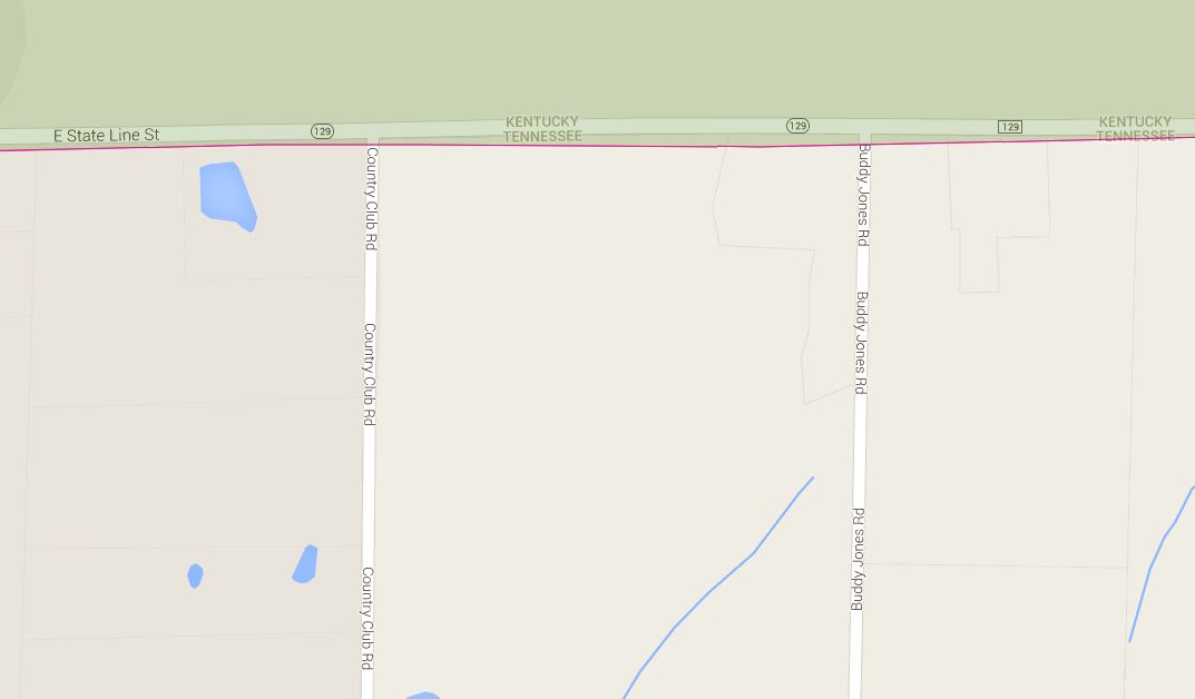
(As you can see, it’s TOTALLY on the way from Cincinnati to Chicago). Anyway, while I was there, I thought I would take a short detour to get 2 new counties in Tennessee (Obion and Weakley). There is a road that goes east of Fulton, Kentucky State Route 129 (pictured below)

I thought that this road was on the KY/TN state border (I mean come on, it’s called STATE LINE STREET!) and so driving on the south side of the road would count me as having visited Tennessee. It wasn’t until a few years later that I realized that the entirety of the road was in Kentucky (perhaps I should have been clued in by the fact that it’s KENTUCKY State Route). In any case, I had to take 2 counties off of my total.
Fixing the mistake
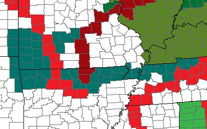
For the past week, we have been in Branson, Missouri. As part of our journeys to, from, in and around, I have added 43 new counties to my total (marked in dark turquoise on my county map)

Most importantly, over 9 years later, I have now finally visited Obion and Weakley counties in Tennessee, along with Lake County, which is in the very NW corner of Tennessee and quite hard to get to as it’s nowhere near anything. If I had had a bit more time, I’d have continued north in Lake County a bit more to visit the Kentucky Bend, which is a small peninsula of Kentucky that is only accessible by going THROUGH Tennessee. It was cut off from the rest of Kentucky by the 1812 New Madrid earthquake.
This site is part of an affiliate sales network and receives compensation for sending traffic to partner sites, such as thepointsguy.com. This may impact how and where links appear on this site. Responses are not provided or commissioned by the bank advertiser. Some or all of the card offers that appear on the website are from advertisers and that compensation may impact on how and where card products appear on the site. Any opinions expressed in this post are my own, and have not been reviewed, approved, or endorsed by my advertising partners and I do not include all card companies, or all available card offers. Terms apply to American Express benefits and offers and other offers and benefits listed on this page. Enrollment may be required for select American Express benefits and offers. Visit americanexpress.com to learn more. Other links on this page may also pay me a commission - as always, thanks for your support if you use them


 Dan Miller travels with his wife and 6 (SIX!) children. He loves to help families travel for free / cheap, especially larger families. If you are looking for help, drop him an email at
I remember a story about the first guy to visit all US counties. After he was done, he sent a note to the Guiness Book.
And they said – prove it.
So, the story goes – he revisited all the counties again, this time taking a selfie at each county sign.
I still think it’s a bit crazy to do but more power to you. I have been to all but 3 states but there’s a handful that I have barely seen anything of. I’d like to go back and at least see enough that I have some kind of feel for some part of the state. I realize driving across an entire state (say TN for example) and stopping for a night or even two is not really seeing much of the state but it gives one an idea of at least what part of it is like.
This is what ya get for looking at maps. 🙂